HOME WHO WE ARE NEWS / EVENTS PUBLICATIONS GALLERY RESOURCES CONTACT

BIENNIAL REPORT
2005-2006


CONTENTS

    *Title Page
    *Background &
      Introduction
    *The Watershed
    *Research
    *Education &
      Advocacy
    *RiverFest
    *Marketing
    *Fundraising &
      Planning
    *Board of Directors
    *Staff & Volunteers
    *Partnerships &
      Major Donors
    *Membership

PRINTER-FRIENDLY
PDF-format
Size 2.9 MB

 Download time:     Dial-up - 12 minutes
    High-speed - 1 min

Download Link


Back to Publications


Click the link below to download the free Adobe Reader


The Watershed

wa·ter·shed - [waw-ter-shed, wot-er-shed]
the region or area drained by a river, stream, etc.; drainage area.
Random House Unabridged Dictionary
© Random House, Inc. 2006

The 73.78 square mile St. Mary's River Watershed encompasses almost a quarter of St. Mary's County's 296 square miles. Over 100 miles of streams in 16 subwatersheds drain into the St. Mary's River before the river becomes tidal at Tippity Witchity Island. Other small streams give their freshwater directly to the tidal estuary.

The estuary extends downstream from the island for about another eight miles before emptying into the Potomac River. The watershed extends from the Route 4 and Route 235 intersection south to St. George's Island and Kitt's Point at the mouth of Smith creek. Nearly half of the St. Mary's County population - 46,000 people - live within the St. Mary's River watershed.

Development in the Lexington Park development district and along Route 235 corridor to California has been intensive in recent years, with resulting threats to its environmental health, particularly as a result of a rapid increase in paved or otherwise impervious surfaces making the river run faster and dirtier. Although the environmental quality of the St. Mary's River and its tributaries remains generally good, inappropriate management could lead to rapid deterioration with adverse economic as well as environmental consequences.

Visit us on the web:

www.SMRWA.org


Click to View a Larger Image in a New Window

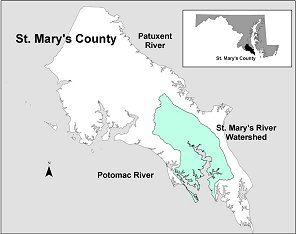
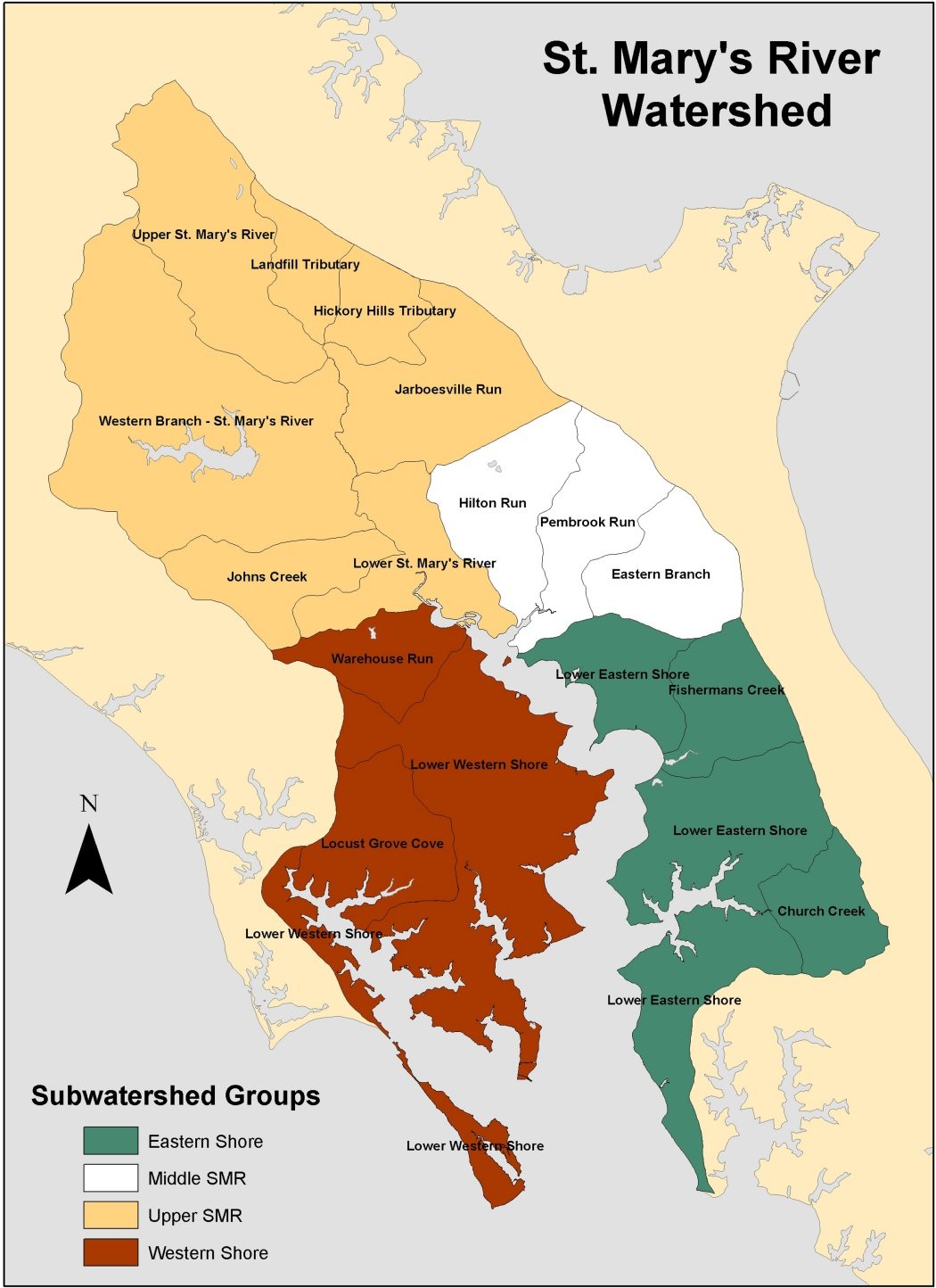
Illustrations Courtesy St. Mary’s River Project.

Previous Page          Top of Page          Next Page


<

HOME    |     WHO WE ARE    |     NEWS / EVENTS    |     PUBLICATIONS    |     GALLERY    |     RESOURCES    |     CONTACT US

St. Mary's River Watershed Association, Inc.
Post Office Box 94
St. Mary's City, MD 20686

©  Copyright 2005 - 2009  St. Mary's River Watershed Association, Inc.