
Since 2017, we have been working with the Friends of St. Clement’s Bay to restore the oyster population in Breton Bay.
Historically, Breton Bay was a hub for oysters in the Chesapeake Bay. The Yates survey (conducted 1906 to 1912) found that 28% of the river bottom was comprised of oyster bars, and the Bay Bottom survey (conducted 1974 to 1983) found that 69% of the bottom surveyed was oyster reef habitat. However, by 2010, only 13% of Breton Bay was classified as oyster reef habitat in the Maryland Geological Survey.
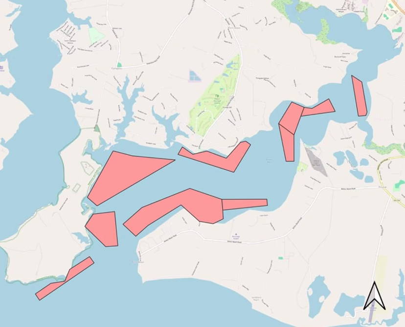
In 2017, Friends of St Clements Bay (FSCB) began restoring Breton Bay through the Marylanders Grow Oysters program with a 0.77 acre site by the Maryland Department of Natural Resources (DNR). As the project continued to grow, FSCB and SMRWA were able to expand the size of the restoration site, which currently includes about one and a half acres. The area is located right off Lovers Point in the middle of Breton Bay.
Since the first planting in 2018, we’ve planted over 4.5 million oysters on this site.
With seven years of plantings, we decided it was time to conduct scientific surveys to gather data on the current oyster populations and track our progress. In September 2025, we invited a research team led by Dr. Matt Gray from the University of Maryland Center for Environmental Science to survey the site using their aquatic drone, S3AM, which uses sonar to survey oysters on aquaculture leases and restoration projects. The equipment is still in its testing phase, so our reef was an opportunity for the team to test whether the drone could measure oyster density. The density measurements taken by the drone will eventually be compared to density measurements taken by a diving crew to evaluate accuracy of the drone’s survey data.
First, the drone conducted a survey of a small area of the restoration site in the middle portion of the site. Then, Dr. Matt Gray and one of his students dove on the site with SCUBA to sample the same sites for oyster density.
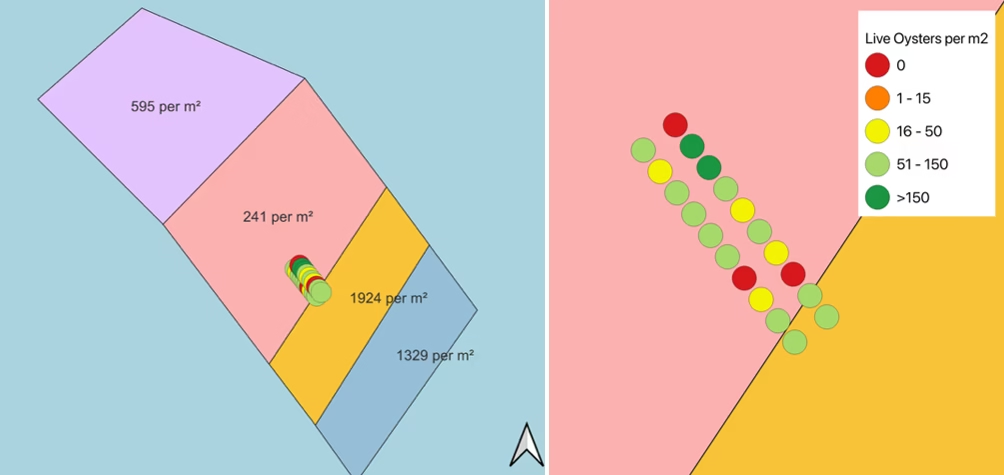
While we don’t have the drone density data yet, we do have the diver data. Twenty density samples were taken by the divers. Only three of the samples (15%) had no oysters present, 13 of the samples (65%) had over 50 oysters per square meter, and two samples (10%) had more than 150 oysters per square meter. The average density was 72 live oysters per square meter, which is well above the 50 oysters per square meter target for a self-sustaining reef defined by the Chesapeake Bay Program. Additionally, there were multiple age classes present, which is another criteria for a self-sustaining reef.
In addition to the density measurements, the team was also able to record an underwater video of the oyster reef near the sampling area.
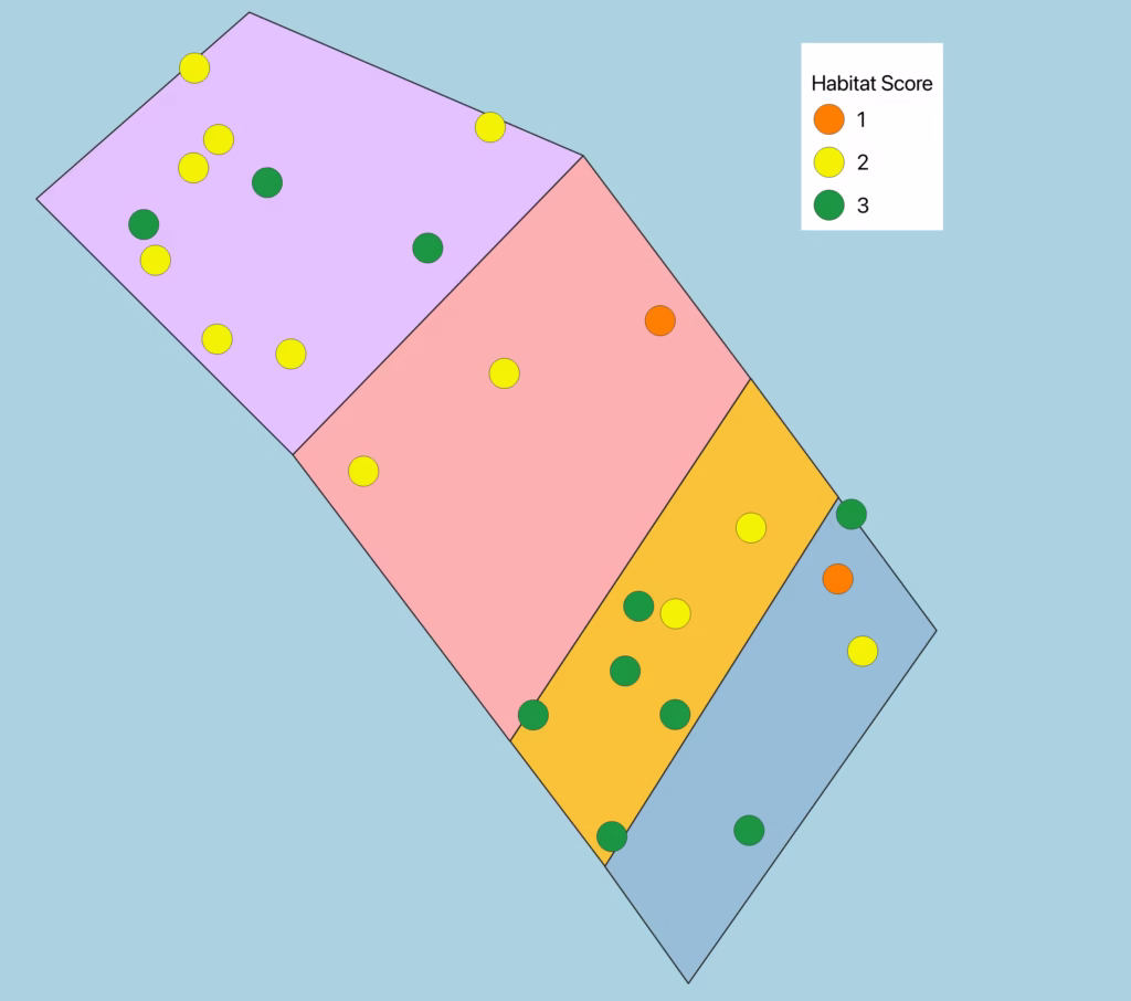
Since the density measurements were taken in a very contained area, we wanted to get a better idea of the conditions throughout the reef. We contacted Dr. Allison Tracy from the Institute of Marine and Environmental Technology (IMET). In December 2025, she came to the site with her OysterCam and used the Rapid Assessment Protocol to evaluate the habitat on our reef. This is a qualitative assessment that assesses reef height and percent coverage. Even though the scores are qualitative (exploratory and observational), high RAP scores can predict high oyster density, biomass, reef height, rugosity and multiple size classes, especially on restored reefs. This method is especially good at identifying high-density oyster reefs. Typically, restored oyster reefs will have RAP scores of two or three.
RAP Scoring Classifications:
| Habitat Score | Definition |
| 0 | No oysters were present in the sample |
| 1 | Less than 50% coverage of oysters in sample |
| 2 | Greater than 50% coverage of oysters but reef height was less than one oyster high |
| 3 | Greater than 50% coverage of oysters and the reef height was greater than one oyster high |
Typically, restored oyster reefs will have RAP scores of two or three. Of the 24 samples taken on the reef, 90% of the samples ended up in this 2 to 3 range. All of the samples had oysters present. Two samples had less than 50% coverage of oysters – these were considered ‘ones’. Twelve samples had greater than 50% coverage with oysters, but were less than one oyster in height, so were scored as ‘twos’. Ten samples had more than 50% coverage and the reef height was greater than one oyster high – these were ‘threes’.
On March 9, we brought these results to representatives at the Maryland Department of Natural Resources. As their four-point oyster sanctuary plan continues and the oyster restoration efforts in Maryland expand, we will continue to petition for Breton Bay to be added to DNR’s list for restoration.
We are thrilled with the results of these two surveys and look forward to sharing our progress with you as work continues on the oyster restoration project in Breton Bay.